
 |
| AP Photo of Kinyon Road wildfire near Buhl, Idaho, July 10. |
This morning I woke up at about 4 a.m. to let cats out of the house, and the entire house smelled like fire. After a few seconds of panic in which I tried desperately to remember when was the last time I'd checked the batteries in our smoke detector, I remembered seeing on the news that there were fires burning somewhere in the area, and the wind must've finally blown the smoke into town. The first thing I wanted to know upon sitting down at my computer this morning was where and how large these fires were. Fortunately, I found a few sites that combine up-to-date fire information from dozens of national and local fire agencies.

The site tracks wildfires in all states, including number of fires, acreage, containment, and whether structures are threatened or evacuations are in effect.

InciWeb is a similar site providing additional details about many of the larger fires found on NIFC. It includes a brief narrative overview of the fire, including containment details and information about what areas or structures have burned. In the case of the fire today for example, the burned area includes the range of a wild horse herd that appear not to have been harmed.
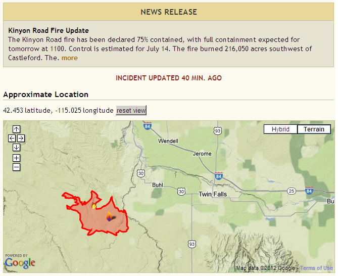
One of the best features of InciWeb is the Google Maps overlay that lets you see the most recently-updated extent of some of the fires. Especially when viewed in the terrain overlay, it's easy to see where the fire is in relation to other locations.
No comments:
Post a Comment